
The U.S. Geological Survey (USGS) Earth Explorer is a powerful online platform for discovering, searching, and downloading a vast collection of Earth observation data. This data, acquired from various satellite missions, provides valuable insights into our planet’s landscapes, resources, and environmental processes.
To begin your exploration of Earth observation data using USGS Earth Explorer, follow these steps:
Table of Contents
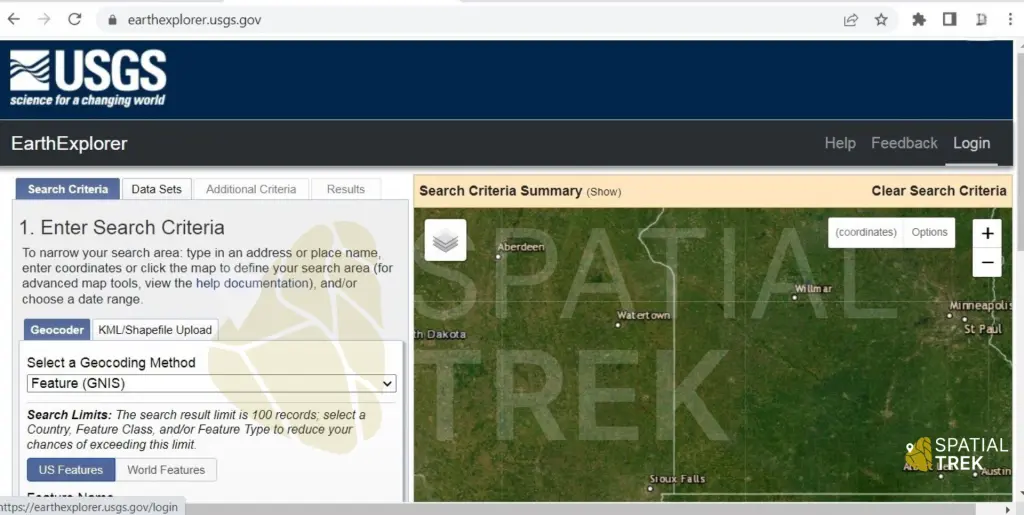
Step 1: Navigate to the USGS Earth Explorer Website
Launch your preferred web browser and visit the official USGS Earth Explorer website at https://earthexplorer.usgs.gov/. This website serves as your gateway to a wealth of Earth science data.
Account recommended: For frequent downloads and managing history, create a free USGS Earth Explorer account.
Click “Login” in top right corner to access existing credentials or initiate account creation.
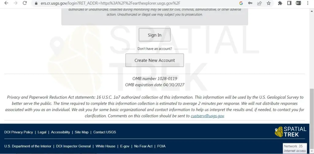
Step 2: Create new account or login
New Users: To unlock the full potential of USGS Earth Explorer, consider creating a free account. This allows you to “Maximize download capabilities” & “Manage download history“.
Existing Users: If you already have a USGS Earth Explorer account, proceed by entering your registered username and password in the designated login fields.
Note: Although account creation is optional, it offers significant benefits for frequent users of Earth Explorer.
Step 3: Search & Select – Finding Your Desired Data on USGS Earth Explorer
This step empowers you to delve into the vast collection of Earth observation data on USGS Earth Explorer. Here’s how to pinpoint the specific dataset you need:
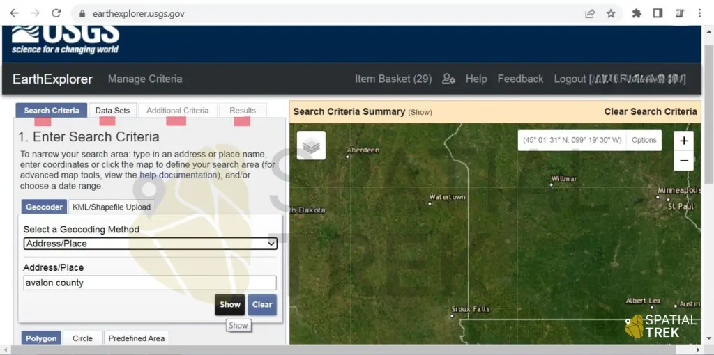
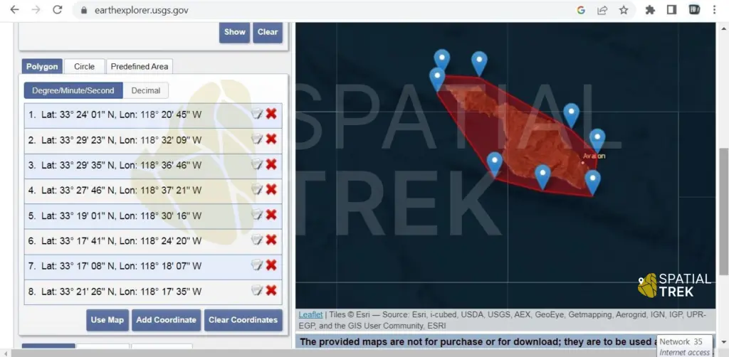
- Location: Enter the geographic area of interest. You can use various methods, such as city names, zip codes, uploading a KML/Shapefile, manually defining your area of interest by drawing polygon or even latitude/longitude coordinates.
- Selecting the Data Range: Within the search results, pay close attention to the “Data Range” section. This allows you to specify the desired timeframe for your data.
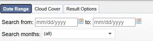
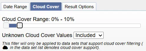
Cloud Cover Percentage: For clear and interpretable imagery, opt for datasets with minimal cloud cover (ideally 0% or close to it).
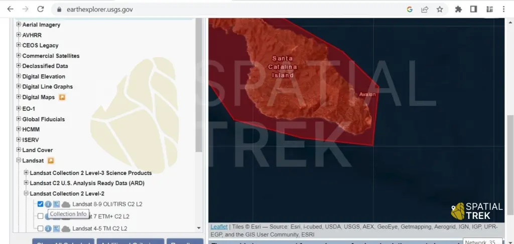
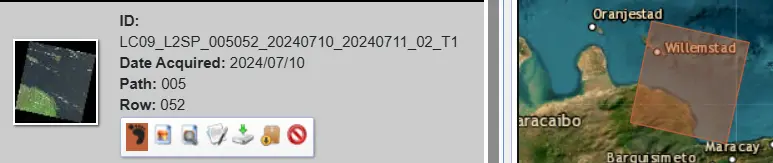
- Pinpointing Your Desired Landsat Data: After clicking on your search results, locate the “Landsat” data option. This section will display available Landsat datasets that match your criteria. Select the specific Landsat scene that aligns with your location, date range, and cloud cover preferences.
Remember: Experiment with different search combinations to find the optimal dataset and consider the trade-offs between data availability and cloud cover when selecting your Landsat scene.
By following these steps and leveraging the search functionalities of USGS Earth Explorer, you’ll be well on your way to acquiring the Earth observation data that fuels your research or project.
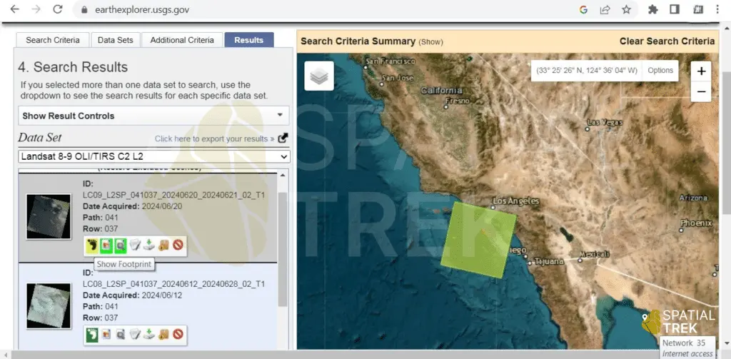
Step 4: Select Scenes or Imagery
Browse the search results and choose the scene you wish to download. After the data selection will click on additional criteria here you can choose any option according to your data usage or research. You may use the “Select Scenes” feature to manually select particular scenes.
Additional Information
Mapping Your Data’s Reach: Footprints Imagine a map outline – that’s the footprint. Footprints ensure you understand the exact geographic extent of the data you’re considering.
Browse Overlay: A Visual Preview of Your Data Browse Overlay provides a visual preview of the scene superimposed over a base map. This allows you to assess scene coverage and quality before download.
Compare Browse: Spotting the Differences Take visual comparisons a step further with Compare Browse. This functionality allows you to display two or more Landsat scenes side-by-side. It proves particularly helpful for change detection, where you can analyze changes in land cover, vegetation patterns, or cloud cover over time.
Bulk Download: Power Up Your Data Acquisition For projects demanding extensive data sets, the Bulk Download feature is your ally. It allows you to download multiple Landsat scenes simultaneously.
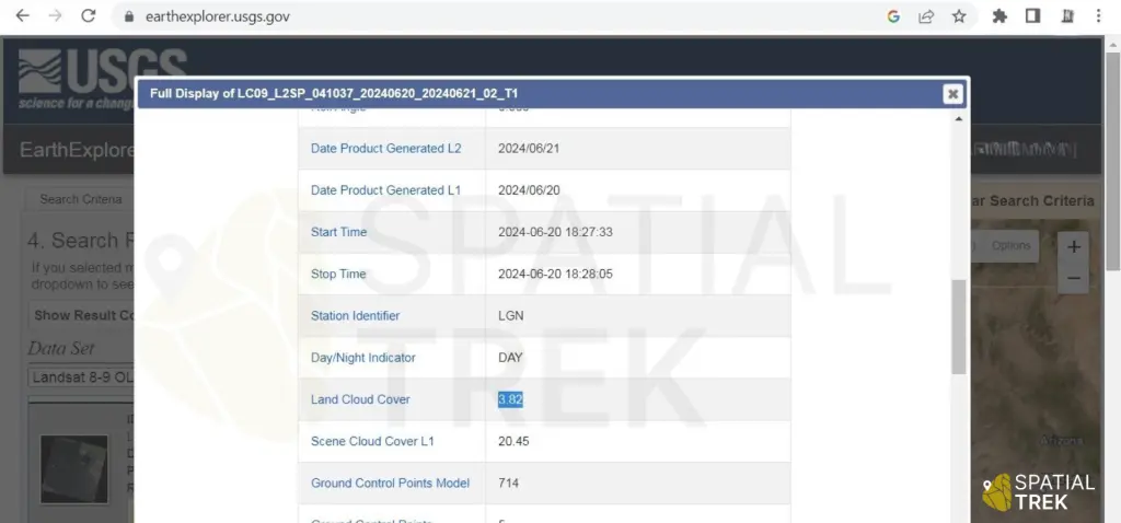
Show Metadata: Unveiling the Data’s Story This data “characteristics” offers crucial insights into the scene’s characteristics, including:
- Scene identification details like ID, path, and row identifiers
- Acquisition details like date and time the satellite captured the imagery
- Sensor and platform information used to acquire the data
- Cloud cover and quality metrics that can impact data usability
- Precise geographical extent of the scene, including boundary coordinates
By mastering these features, you’ll transform USGS Earth Explorer into a powerful tool for locating, visualizing, and acquiring the Earth observation data that fuels your research and projects.
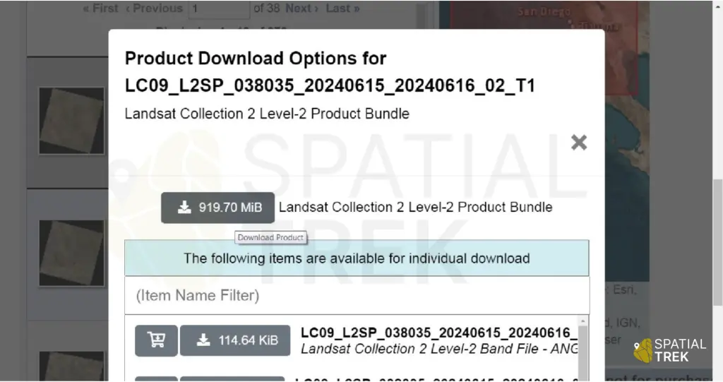
Step 5: Review and Download
Review your selection and data options. Click “Download” for options
- Bulk download
- Single band download
Depending on the size of the data, the download may take some time.
Additional Resources
You can also access a vast array of Earth observation data from these trusted sources:
- NASA Earth Observing System Data and Information System (EOSDIS): https://search.earthdata.nasa.gov/
(Offers a vast collection of Earth observation data, including Landsat, Sentinel, MODIS, and others) - European Space Agency (ESA) Earth Observation Portal: https://earth.esa.int/eogateway/catalog
(Provides download options for Sentinel data) - National Oceanic and Atmospheric Administration (NOAA) National Centers for Environmental Information (NCEI): https://www.noaa.gov/climate
(Houses a variety of environmental datasets, including DEMs and land cover data) - National Geospatial-Intelligence Agency (NGA) Geospatial Data Services: https://www.nga.mil/
(Offers access to high-resolution topographic data and imagery)