Ready to unlock the power of spatial analysis? This guide will walk you through using essential ArcGIS tools like Clip, Dissolve, Buffer, and Union to transform your data.
Table of Contents
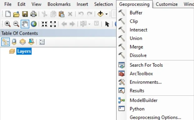
Accessing Geoprocessing Tools
- Locate the ArcToolbox: Typically found in the lower left corner of the ArcMap interface.
- Access from the Menu: Navigate to the “Geoprocessing” tab within the ArcMap ribbon.
In the following sections, you will learn about specific tools, techniques, and real-world applications to help you master the art of geoprocessing in ArcGIS.
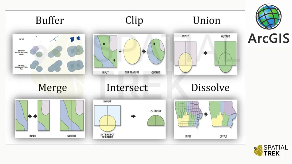
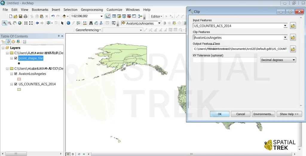
Clip Tool
- Access tool from toolbox or menu > select the input feature class or layer.
- Choose the clip method (e.g., polygon, rectangle, circle).
- Define the clip extent (e.g., select a polygon feature, enter coordinates).
- Set the output feature class or layer.
- Run the Clip tool.
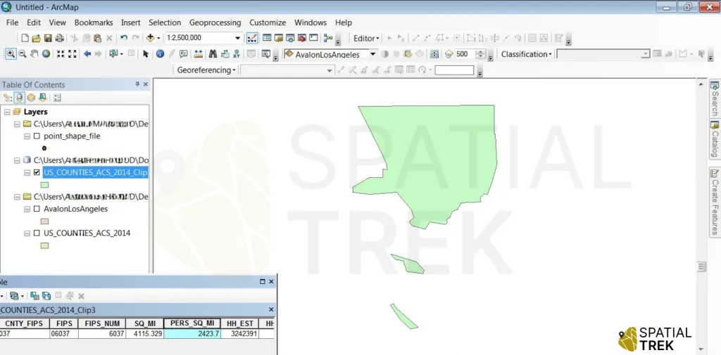
Successful Tool run > the AOI extracted from US administrative boundary by clipping.
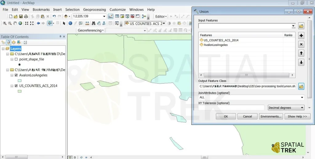
Union Tool
- Access tool from toolbox or menu > Select the input feature classes or layers (at least two).
- Choose the union method (e.g., union, combine).
- Set the output feature class or layer.
- Run the Union tool.
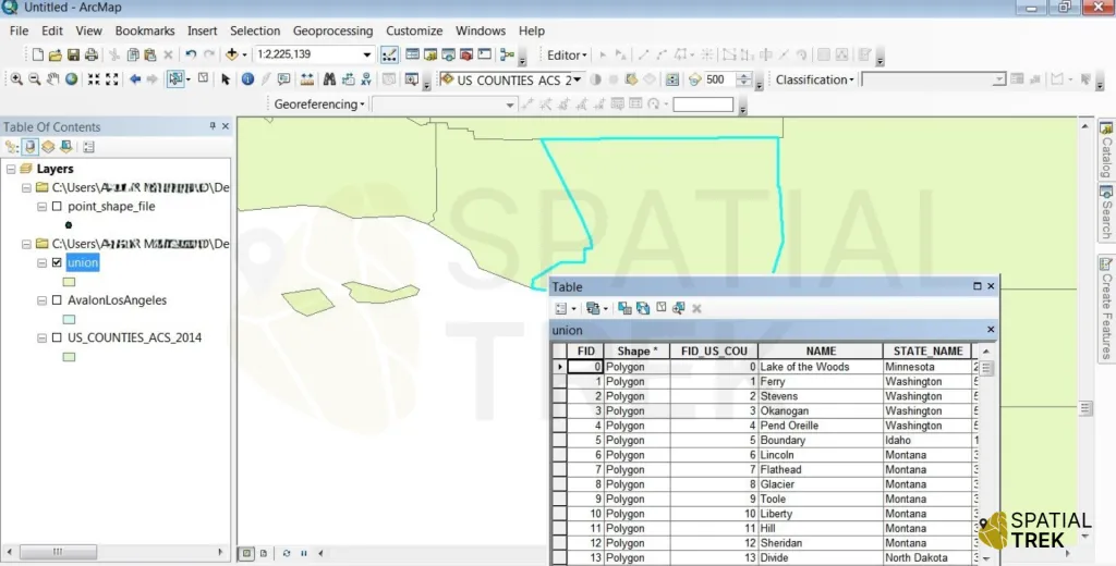
Successful Tool run > two different layers combine into one by union tool.
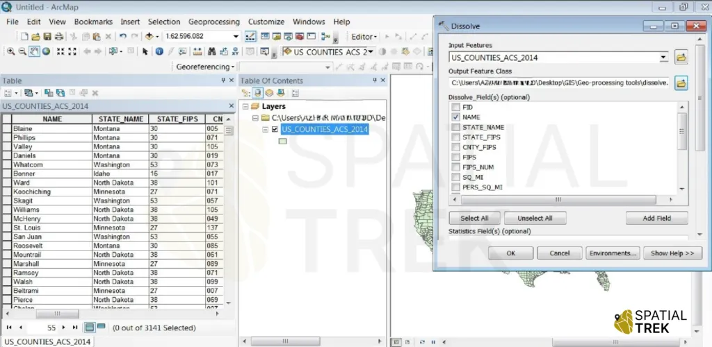
Dissolve Tool
- Access tool from toolbox or menu > Select the input feature class or layer.
- Choose the dissolve method (e.g., dissolve boundaries, dissolve attributes).
- Select the dissolve fields & output feature class or layer.
- Run the Dissolve tool.
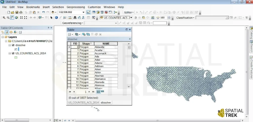
Successful Tool run > now adjacent features are dissolved or combined.
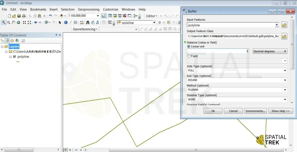
Buffer Tool
- Select the layer or feature class around which you want to create a buffer zone.
- Determine the type of buffer to create, such as a fixed distance buffer or a variable distance buffer based on attribute values.
- Specify the desired buffer distance or provide an expression to calculate variable distances.
- Choose an output location and name for the resulting buffer feature class.
- Run the Buffer tool to create the buffer zones around the specified input features.
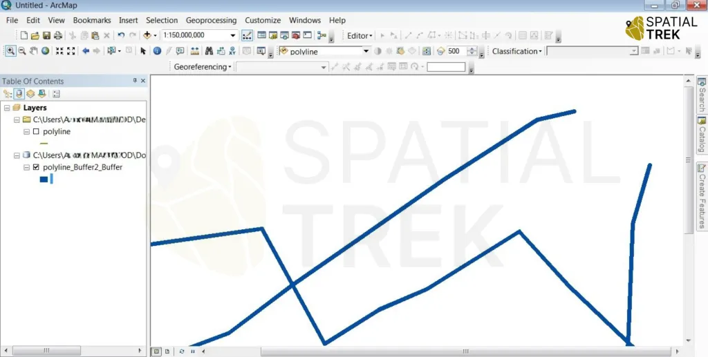
Successful Tool run > The buffer expands around input features at a specified distance.
Advantages and Applications
Clip
- Extracts features within a specified boundary: Used for isolating data within a specific region of interest.
- Example applications: Extracting land cover data for a specific county, creating study areas.
Union
- Combines multiple feature layers: Creates a new feature class containing all features from the input layers.
- Example applications: Overlay different thematic layers to identify spatial relationships, create complex land use/land cover maps.
Dissolve
- Aggregates features based on common attributes: Simplifies data by combining overlapping or adjacent features.
- Example applications: Combining adjacent polygons with the same land use type, creating administrative boundaries.
Buffer
- Creates buffer zones around features: Useful for proximity analysis, site suitability studies, and service area delineation.
- Example applications: Identifying areas within a certain distance of a road, creating buffer zones around protected areas.