Geodatabases and shapefiles are fundamental building blocks in GIS. Geodatabases provide a structured framework for managing geographic data, while shapefiles offer a simple format for storing vector data.
This guide will walk you through the process of creating both to establish a solid foundation for your GIS projects.
Table of Contents
Creating a Geodatabase
To create a geodatabase within ArcGIS, follow these steps:
- Initiate ArcGIS Software: Launch the desired ArcGIS application, such as ArcMap or ArcGIS Pro.
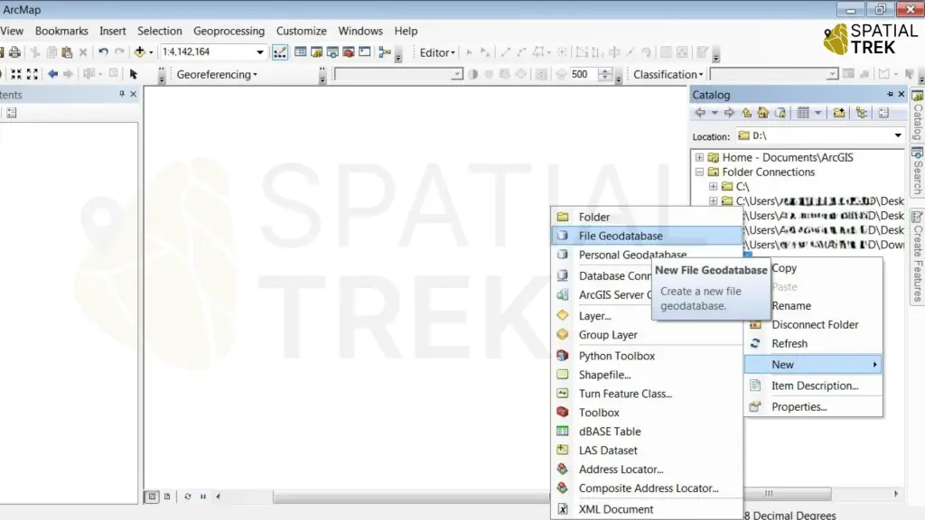
- Access the Catalog Window: Open the Catalog window to navigate your project’s file system.
- Navigate to the New Geodatabase Option: Click on the “File” menu, followed by “New” and then “Geodatabase.”
- Define Spatial Reference System (SRS): Select an appropriate spatial reference system that aligns with your data’s coordinate system.
- Confirm Geodatabase Creation: Click “OK” to finalize the geodatabase creation process.
Create a Point Shapefile
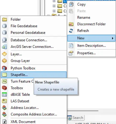
- Open Catalog: Access the Catalog window in ArcGIS.
- New Shapefile: Navigate to desired location, right-click, select “New,” then “Shapefile.”
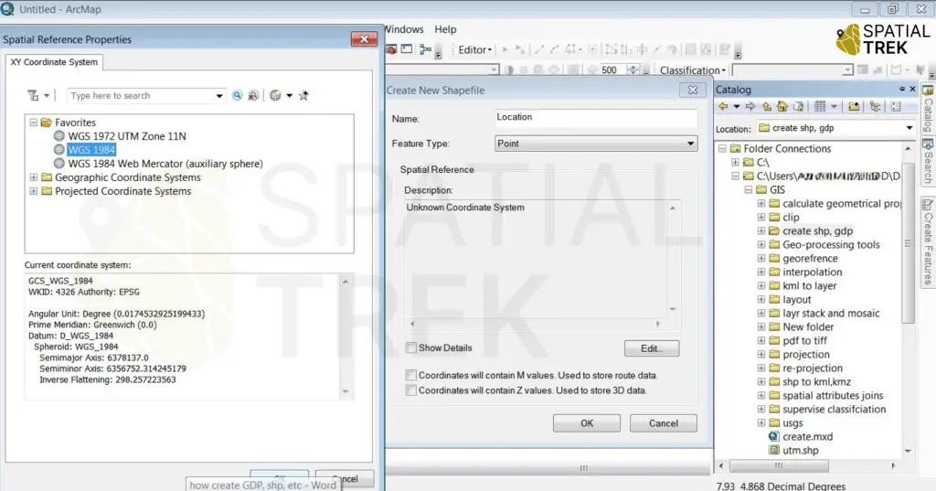
- Define Shapefile: Name the shapefile, choose “Point” as feature type, and set coordinate system.
- Create: Click “OK” to create the point shapefile.
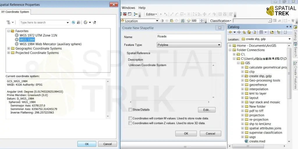
Create a Polyline Shapefile
- Open Catalog: Access the Catalog window in ArcGIS.
- New Shapefile: Navigate to desired location, right-click, select “New,” then “Shapefile.”
- Define Shapefile: Name the shapefile, choose “Polyline” as feature type, and set coordinate system.
- Create: Click “OK” to create the point shapefile.
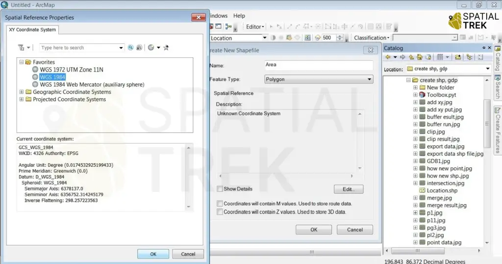
Creating Polygon Shapefile
- Open Catalog: Access the Catalog window in ArcGIS.
- New Shapefile: Navigate to desired location, right-click, select “New,” then “Shapefile.”
- Define Shapefile: Name the shapefile, choose “Polygon” as feature type, and set coordinate system.
- Create: Click “OK” to create the point shapefile.
With geodatabases and shapefiles at your disposal, you’re ready to create and edit a variety of geographic features, including points, lines, and polygons.
Understanding the Differences
- Geodatabase: A container for storing and managing geographic data. It’s like a database for spatial information, offering better data integrity, performance, and advanced capabilities compared to shapefiles.
- Shapefile: A simple vector data format for storing geographic data. It’s suitable for basic mapping and analysis but lacks the advanced features of a geodatabase.
- Point Shapefile: Represents data as single locations, like cities or wells.
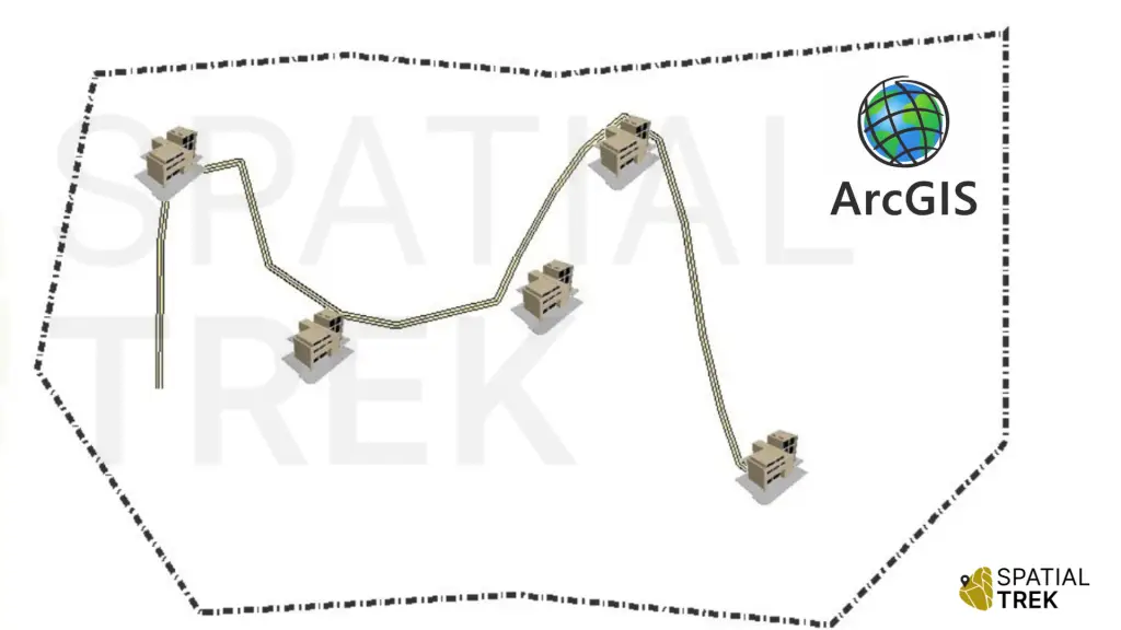
- Polyline Shapefile: Represents linear features like roads, rivers, or power lines.
- Polygon Shapefile: Represents areas with closed boundaries, such as parcels, lakes, or countries.
Conclusion
- Geodatabases are containers for organizing different types of geographic data.
- Shapefiles are specific types of data within a geodatabase or as standalone files, representing points, lines, or areas.